Denali
National Park, Part
1.
June 6-13,
2016
Part
1. Overview and 1st
week in
the front country in Denali
We had an easy drive of about 125 miles from Fairbanks to Denali NP. For the first week we stayed at Riley CG, just inside the entrance to the NP.

This is a long post with lots of pictures.
Front country is a term referring to the area near the entrance and the area you can drive your private vehicle to. Back country would be everything beyond MM15 and the Savage River on the park road.
Front country is a term referring to the area near the entrance and the area you can drive your private vehicle to. Back country would be everything beyond MM15 and the Savage River on the park road.
Initially
we were not sure if we were going to visit Denali. We were here for
3 days in 1999 so it was not like
we hadn't see the park before.
While
we were staying in Fairbanks, I began looking at info about Denali NP
and realized there is a number of things we didn't see and do on our
short stay the first time we were in Alaska.
If
we were going to visit Denali, we definitely wanted to stay at Tek'
(Teklanika Campground). Tek is 14 miles past the point that you can
drive private vehicles to on the park road. An
exception is, if you have reservations to stay at Tek CG you may take
your RV to Tek.
Rules
and information about Tek CG:
To
stay at Tek you must stay for a minimum of 3 nights. Also once you
are at Tek, if you go back to the front country part of the park you may not return to Tek. The main attraction at Tek is, your are in the back country away from most of the crowds and
you can get a “Tek Pass”. This is a bus pass giving you a
reserved seat on a shuttle bus to the interior of the park, usually
for the first full day you are at Tek. After that first day you can
hop on any shuttle bus, space available, for
no additional charge, and ride as far into the
park as you wish. The Tek pass is $35.
The bus will drop you off anywhere you wish and you can day hike.
When you finish your hike, just return to the road and flag down any
bus, which has space available, and ride it back to Tek.
Typical
shuttle bus trips into the park are to Eielson Visitor Center at about
MM65 and/or to Wonder Lake at about MM85. Both are well worth
visiting. Keep in mind these are all day trips. The round trip from
Tek to Eielson is about 6-7 hours and to Wonder Lake is about 8-9
hours. If you start from the park entrance area the trips are about
2.5-3 hours longer. That is another reason to stay at Tek. A
shorter bus ride.
There are a few large, as in long, campsites in Tek. I read in a blog where someone brought their 40' fifth wheel pulled by a HDT (Heavy Duty Truck, i.e. 18 wheeler) and got both the truck & trailer in one of the campsites. HOWEVER none of the campsites in Tek are assigned. If you arrive late in the day, all the campsites large enough for your rig may be occupied. Either stay at Riley CG or outside the park but near enough to arrive at the Savage River check point by about 9am and then drive to Tek.
There are a few large, as in long, campsites in Tek. I read in a blog where someone brought their 40' fifth wheel pulled by a HDT (Heavy Duty Truck, i.e. 18 wheeler) and got both the truck & trailer in one of the campsites. HOWEVER none of the campsites in Tek are assigned. If you arrive late in the day, all the campsites large enough for your rig may be occupied. Either stay at Riley CG or outside the park but near enough to arrive at the Savage River check point by about 9am and then drive to Tek.
While
we were in Fairbanks, I checked the online Denali
NP CG reservation system.
Lots of campsites at Riley CG near the entrance, but limited
availability for Tek. The only 4 day openings at Tek were for the
2nd
week we would be in the area, so I made reservations for 7 nights at
Riley CG and then we moved to Tek CG for 4 more nights from 6/13-17.
That really turned out well for us. It was somewhat cloudy with
couple of days of rain the 7 days we were at Riley CG.
However the last 3 days we were at Tek, were bright and sunny. We were fortunate that we got to see Denali Mountain without any clouds obscuring the view.
The park says only about 25% of the visitors to Denali get to see the
mountain at all. Even then the mountain is partly obscured by clouds.
Sometimes the lower part is obscured, other times you can see the top
and bottom, or only the top is obscured. We were told that only
about 10% of the visitors get to see Denali Mt totally visible.
The
front country part of Denali
We
thoroughly
enjoyed visiting
the Sled Dog Demonstrations. We visited with & petted
the dogs. Then watched the dogs pull the sled around a loop and stop in
front of seating area. Once the dogs were settled down, a ranger gave a 15 minute talk about the dogs and the role they play in the park.
If
you take the
free shuttle
bus to the kennels, you will arrive early enough to have about 15
minutes to visit with the dogs. If you drive, plan on arriving
30-45 minutes before the show because there is limited parking. You can visit with the dogs while you
wait.
The dogs are on about 10'-15' chains at their individual dog house.
Some of the more gregarious dogs are available for petting. Several
of them just lay on top of their house waiting for you to come pet
them.

Sharon,
on her scooter trying to pet one of the dogs. I think the dog was leery of the scooter. Probably had never seen one before. While she had difficulty getting close enough to this one, she was able to pet several of them. This gave her, her dog "fix" for the week

After
all the visitors are seated at a viewing area, the ranger giving the
talk blows a whistle to signal the dog handlers to harness the dogs
to sled. As soon as the whistle blows all the dogs jump up, start
barking and running to the end of their chains. They all want to be
hooked to the sled and go for a run.
One
of the handlers rides the sled around a loop and stops in front of the
viewing area.


They
give the dogs a chew toy to keep them quiet and entertained while the
ranger gives about a 15 minute talk about the dogs and their function
in the park.

The
primary reason to have the dogs in the park is for winter patrols.
Most of Denali is wilderness so the rangers can't patrol with
snow-machines.
With the park having about 30 dogs in the kennel, it would really tax the resources of the workers to exercise all the dogs. They came up with an innovative program to insure the dogs are exercised. All the seasonal employees in the park and maybe the area, hotel clerks, gift shop workers, interpretive rangers, can apply to take a dog out for a run or walk. They have to commit to doing this at least 3 days a week. As the interpretive ranger said, if you have had a stressful or bad day there is nothing like coming out and going for a run with "your dog".
With the park having about 30 dogs in the kennel, it would really tax the resources of the workers to exercise all the dogs. They came up with an innovative program to insure the dogs are exercised. All the seasonal employees in the park and maybe the area, hotel clerks, gift shop workers, interpretive rangers, can apply to take a dog out for a run or walk. They have to commit to doing this at least 3 days a week. As the interpretive ranger said, if you have had a stressful or bad day there is nothing like coming out and going for a run with "your dog".
–
The
Denali Visitor Center
is well worth a stop for an hour or so to view the displays of the
park and watch the short video of the park.
–
Drive
the park road to MM15, Savage River
– MM15 is far as you can drive a private vehicle unless you have reservations at Teklanika CG at MM29.
– Walk the ½ mile loop trail at Mountain Vista Loop at about MM12. If the weather is clear, there are nice views of Denali Mt. Also very good information displays about the first tourist accommodations at what was then Mt. McKinney NP.
Views of Denali Mt.
from at or near Mountain Vista Loop. The views of Denali, obscured by clouds, are typical of the views the 25% of the visitors get to see. The other 75% don't even get to see the mountain because of all the cloud cover.


Information
about Hiking in Denali here.
Before
you hike in the park you should read through this web page.
–
If
you like to hike, take the best hike in the park on a
maintained trail, Savage Alpine Loop Trail.
This
hike is not well publicized, in fact it seems to be a well kept
secret. Very little info available online from the NP. The trail
is considered strenuous. I would call it more than moderate, but way
less than strenuous. It is a 4 mile 1490' elevation gain trail.
However, if you start the
trail at
Mountain Vista Loop
parking lot, the climb to the top is
a
slow incline. 1-3% for about 1 mile, about 5-7% the next ½ mile and
then gets pretty steep at 9-12% for
the next 0.9 mile,
until you peak out at about 2.4 miles.
The views are fantastic once you get above the tree line at about 1.5
miles. Don't start the trail from the Savage river end unless you are
in superb condition. Going in this direction the first 0.6 mile is a
25-40 degree climb, mostly stone steps switchbacking up a rocky
incline.
If
steep drop offs concern you, once you peak out and enjoy the views,
return the way you came. If you don't mind the steep drop offs, the
last 1.6 miles offer fantastic views to the west and
a fun climb down a steep trail.
Overview
map of start of trail

Trail Sign

Easy part of the trail

Starting to climb

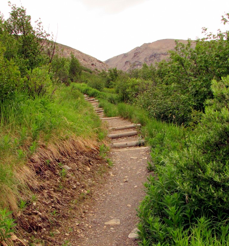
Nice board walk over a marshy area. The park has built a great trail for hiking.

Up
we go

Dall Sheep in the distance. Look for white dots left center.

Getting
pretty high

View to the west. If it was clear I am pretty sure there would be great view of Denali Mt.

Rocky part of trail

Looking west again

Denali somewhere in the clouds

All downhill from here

The trail follows the near ridge line to the point and then switchbacks down the far side

I
had a bit of a surprise at the high point of the trail, seeing two hikers
or climbers above me.
There
are two people at the table rock in this picture

You can see them in this picture. No trail up there. Just scramble over the rocks.

Some very pretty tiny flowers. Note the size of the flowers compared to my glove to the right of the flowers.


Looking
West. The trail follows the ridge line out to the point. If you don't like heights, this is a good place to turn around and go back the way you came.

Alaska
ground squirrel looking for a handout maybe?


Looking west again. Denali should be visible in the distance, except for the clouds.

A
great job of trail building

Looking
west again. You can see the trail following the ridge on the left
side of the photo

More
trail


I
had to get a selfie in

Looking
down to the river. This bridge is as far as private vehicles are allowed to go into the park. There is a checkpoint at the far side of the bridge.

The
trail is switch backing down this slope. The view is looking up the slope.

Rock
steps

You can see some of the switchback to the left and down hill.

Once
you get to the river, get on one of the shuttle buses for the 2 mile
ride back to Mountain Vista Loop
This
is another hiking opportunity which is not well known. Or at least I
didn't know about them
until I poked around the NP website.
Link to Discovery Hikes: https://www.nps.gov/dena/planyourvisit/discovery-hikes.htm
Link to Discovery Hikes: https://www.nps.gov/dena/planyourvisit/discovery-hikes.htm
Discovery
Hikes are all day hikes lead by a ranger. The hikes are limited to 12 persons including the ranger. The 12 limitation is because the hikes are in wilderness areas. Here in Denali, everything more than a few feet off of the park road, is
wilderness. In the wilderness areas, group sizes are limited to 12
people. You ride a shuttle bus to the interior of the park
and the ranger leads you off across country. No trails.
Some
of the hikes are strenuous, with elevation gains of 1000-1200 feet.
Others are walking up a river and are level, but rocky. Usually you
will be exposed to places you will get your feet wet, so be prepared.
The hikes are not marathons. So even if you have an 800' elevation
gain, if you are reasonably fit you can probably do it.
One
potential down side. Your ranger leading the walk is an interpretive
ranger. They may be in their first year or so of
working summers in the park. If so they may not have informed answers to
some of your questions. Others may have been working here for years and will have extensive knowledge of the park and environment.
The
discovery hikes are an excellent way to learn about hiking away from
maintained trails in the park.
Day
hikes in the back country do not require permits. Pick a spot get
off the shuttle bus and start walking.
DO
be cautious about bears, carry bear spray, know what to do if you
meet a bear or other wildlife. When you go on a discovery hike they
will cover these cautions.
I
went on one discovery hike and thoroughly enjoyed it. There is no trail on these hikes. You walk on and over the rocks or on the tundra. Walking on the tundra is kind of like what walking on memory foam would feel like. I was surprised at how easy and comfortable walking on the tundra is.
The weather was cloudy so I didn't take a lot of pictures.
The weather was cloudy so I didn't take a lot of pictures.
Our
hike started at Mile 58 Highway Pass on the park road.
In the photo below, we hiked down the wash/stream behind the ranger, elevation drop of about 350' and then walked up the wash/stream on the other side, elevation gain of 400'. The hike was advertised to have an elevation change of 350'. It turned out to be 750'.

On
the hike I noticed some bright kind of silver/clear things in some
lupines (blue bonnets to us Texans) low to the ground. When I looked closely, I could see these
were large droplets of water, some about as large as a small marble. These droplets are
at the juncture of a number of leaves coming together. I think there is something on the leaves which increases the surface tension
of the water to cause it to form this large droplet instead of flowing
out through the leaves. Even when I touched the goblet of water with my finger it didn't break and flow away. It was like touching a bit of jelly. I thought it was most interesting.


Some views from the hike


Lunch
break

A
bull caribou

A nursery herd of Caribou in the distance. The cows and calves group together for greater protection from predators. Click on the picture to open for a larger image.

On
the bus ride in and out we saw:
Momma
bear and two cubs

Two Bull Caribou in lower left corner

I
think the antlers are still in velvet. They are to far away to be
sure.


–
The
rest of the front country.
There
are other trails in the front country. I didn't get around to taking
them. Most are much easier than the Savage Alpine Loop.
Not
much to say about the area right outside of the park. Pretty much a
tourist area. We did eat lunch at Rosie's Cafe in Healy, about 15
miles north of the park. Good food and good friendly service. Not a
tourist place, serves mostly locals.
We
also ate lunch at a restaurant attached to a cabin rental place at
MM229 on the Parks Hwy. I forget the name. We had a good hamburger.
A bit pricey though at $15.
Savage CG
Denali Part 2 coming up next is about the back country and Teklanika CG.
Link back to the Alaska blog index page.
Campgrounds
in the Front Country
Riley
CG
Riley
CG is near the entrance and close the visitor centers and hiking
trails. Riley
is a large CG, about 200 campsites, with about 25 of them in a walk
in tent only area. Most
of the campsites are in trees, so satellite TV or solar panels are most likely to be unusable. The
campsites are divided between
RV's under
30' and over 30'. There
is a catch to their length designation though. Not all the sites for
RV's 30' and under are large enough for 29' or 30' RV's. Some are
just large enough for a 22' rig. Also many of them are not large
enough to park a 25' trailer and have room for the tow vehicle. There is separate parking available for tow or towed vehicles that won't fit in the campsite. The
over 30' sites are the same way. Many of the sites are not large
enough for 38' to 40' RV's. The prices are $22 for <30 and="" for="" the="">30' sites & $28 for over 30' sites. 50% off if you have a senior or disabled pass.
Tent only sites are $14, if I remember correctly. We had a strong
Verizon cell signal so our phones and internet worked well.
We
got lucky and stayed in campsite #151, a handicapped site, which is open
to the south so our solar panels had sun for about 6-7 hours a day.
When it wasn't cloudy that is. Fortunately, with 650 watts of solar
panels, even on cloudy days we got enough power to keep our lithium
batteries well charged.
Moose and calf near our RV:


The
moose cows with their calves love the area around Riley CG and the
visitor center area. With all the people around the entrance area it
keeps the predators away, so they stay here while their calves are
young. It is nice seeing the moose and calves walking through the
CG. However the cows will be very aggressive if they feel their calf
is the least bit threatened. 600-800 pounds of moose with sharp
hooves will do serious damage to a human.
Be very careful around the moose and calf. The mama will be very dangerous if she feels her calf is threatened. While we were here someone shot and wounded a moose. Here is a link to a newspaper article about the shooting: https://www.adn.com/alaska-news/wildlife/2016/06/07/a-cow-moose-was-killed-near-denali-parks-post-office-park-rangers-want-to-know-why/
It is not clear if the cow had calves or not, but 2-3 weeks later the park captured a pair of orphaned calves that were hanging around the main visitor area. Normally the park does not capture animals like this. They normally just let nature take its course. Generally a predator will kill the calves as a natural part of the wild. However there seemed to be a large concern the calves would not leave the main visitor area. Also the calves were starting to be fed (a big no-no in the national parks) by visitors. Link to an article about the capture of the calves.
Be very careful around the moose and calf. The mama will be very dangerous if she feels her calf is threatened. While we were here someone shot and wounded a moose. Here is a link to a newspaper article about the shooting: https://www.adn.com/alaska-news/wildlife/2016/06/07/a-cow-moose-was-killed-near-denali-parks-post-office-park-rangers-want-to-know-why/
It is not clear if the cow had calves or not, but 2-3 weeks later the park captured a pair of orphaned calves that were hanging around the main visitor area. Normally the park does not capture animals like this. They normally just let nature take its course. Generally a predator will kill the calves as a natural part of the wild. However there seemed to be a large concern the calves would not leave the main visitor area. Also the calves were starting to be fed (a big no-no in the national parks) by visitors. Link to an article about the capture of the calves.
Moose and calf near our RV:

Savage CG
Savage
is at about MM13 of the Park road. About 30 campsites in two loops.
There are trees in this CG, but the trees are pretty well spread
apart so your solar panels should get a
few to several hours of sun a day.
Some of the campsites have a view of Denali Mt on a clear day. The
CG is within about 200 yards of Mountain Vista Loop which has great
views of Denali Mt on a clear day. Pricing is the same as Riley CG.
No Verizon signal. Savage
is a much quieter CG and the campsites are not as tight and cramped as Riley. Except
for the lack of cell phone and internet availability we would much
prefer to stay here.
Denali Part 2 coming up next is about the back country and Teklanika CG.
Link back to the Alaska blog index page.


